 Age level: Upper Elementary, Middle School, High School
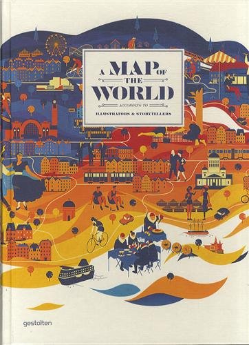
Description: This is a gorgeous book of maps created by illustrators and storytellers. It includes everything from watercolor maps designed as antique maps but illustrating a record label to fictional maps based on film titles, and maps detailing walking tours of Madrid with the focus on food and interesting places to a music map with instruments representing each country creating the shapes of the continents. All in all, this is a book that is thoroughly enjoyed by both older children and adults.
Skills & Modifications: What I especially enjoy about this book is that it can be used to meet your learner at his/her current skill level. The only way that I modify the book is to copy a page (so the learner is not overwhelmed by the amount of material) in order to let the learner look at it in isolation.
- Picture Comprehension – This can be used to practice higher order picture comprehension skills. Each map has a brief description of its theme, but there are so many details that there is a lot for the learner to explore. I’ll usually let the learner choose one map and we discuss it together. For older learners who are still learning to locate items within a larger picture, this book provides great age-appropriate materials for practicing that low-level skill.
- Conversation Skills – This is a great tool for working on appropriate conversational exchanges with older learners, especially for learners who are interested in art. I will open up the book to one map and we will discuss it at length, or I’ll show two maps and we’ll compare and contrast them.
- Maps – While this is not a good resource for practicing common map skills such as using the compass rose or the legend, it is a good resource for discussing the function of maps. Some maps in this book would be solely considered as art, while others could be used to achieve certain tasks.
- Expressive Language – I’ll ask the learner to describe the map in detail. The goal is for the learner to describe the map using multiple sentences and giving a variety of information.
- Class – Sometimes I will cover the brief synopsis of the map with my hand, have the learner study the map, and then have him/her make an educated guess about the class or topic of the map. It’s a nice short-duration activity that the learner enjoys, and it requires a high level of understanding class and synthesizing previous knowledge.
Pros: This is a tool I can use for high-interest, low-level lessons. It can be used for a variety of skills without presenting your learner with materials that are inappropriate for his/her age.
Cons: It’s a bit pricey, but such high quality you won’t mind.
Cost: $60.00 (frequently less expensive on Amazon) You should invest in this book if: you have a learner who is particularly interested in maps and/or art, are seeking high-interest materials for practicing conversation exchanges, or are looking for inspiration for art projects related to maps or geography.
ABLLS: C43, G25, H40, H43, L31
VB-MAPP: Social Behavior 15, LRFFC 12, Intraverbal 14

Leave a comment